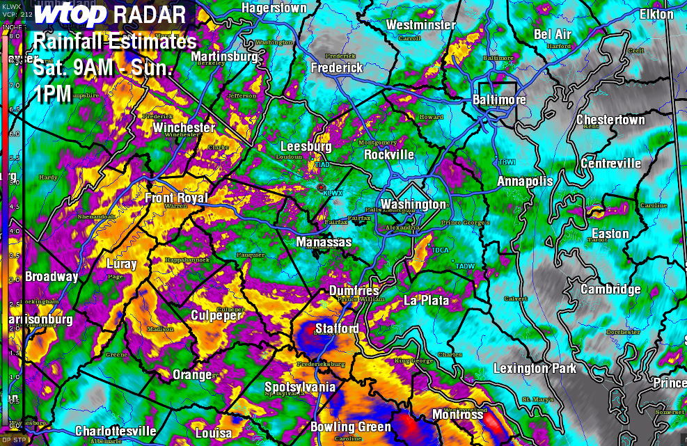
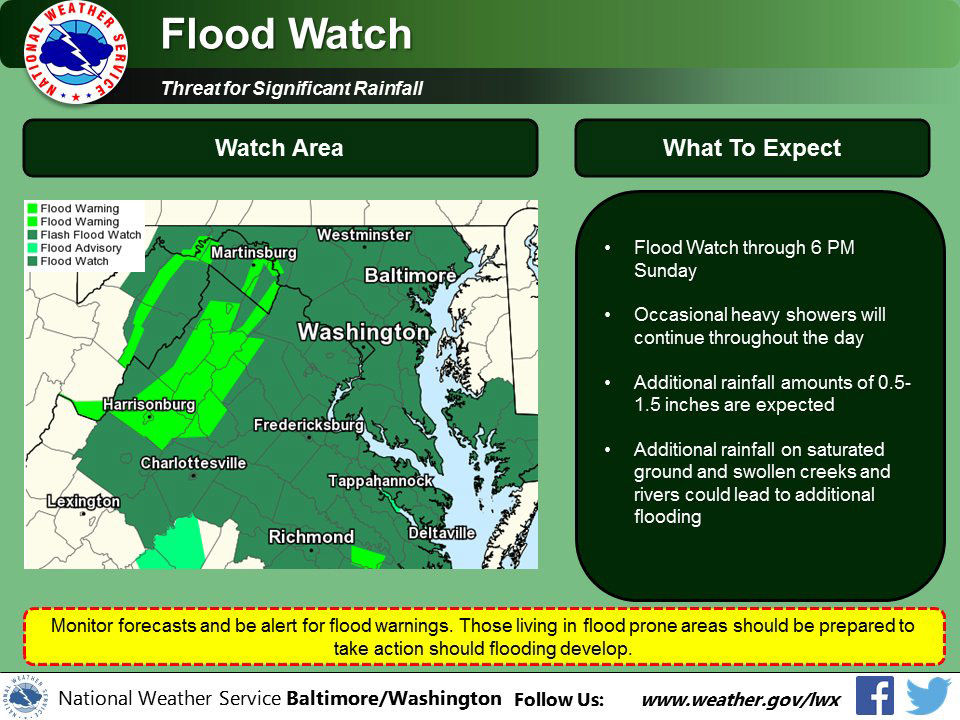
WASHINGTON — With rain forecast for the region throughout Sunday, the National Weather Service issued a series of flood watches and warnings.
Quick Links:
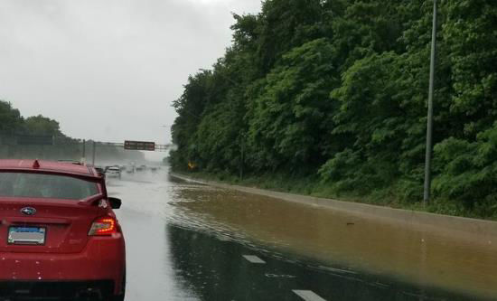
A flood watch means there is a potential for flooding based on current forecasts. A flood warning means flooding is imminent. Flood warnings were issued for communities close to the Potomac River in Loudoun County, Frederick County and Montgomery County, and the Rappahannock River in Fauquier County. The Potomac River near Point of Rocks, Edwards Ferry and Little Falls could reach flood stages sometime on Monday. Montgomery County reported that White’s Ferry in Poolesville, Maryland is now closed due to flood concerns. Most of the D.C. area were under a flood warning overnight. The WTOP Traffic Center received reports of standing water on certain stretches of the Capital Beltway and advises people to drive carefully, with wipers and headlights on for better visibility. A downed tree limb is blocking the right lane of the inner loop close to the Annapolis Road interchange.
I-495/Beltway Inner Loop before MD-450/Annapolis Rd (#20): RIGHT lane BLOCKED, downed tree #PGCo #DCTraffic #MdTraffic @MDSHA
More: https://t.co/nb3VFR1abs pic.twitter.com/jzqjp19gOh — WTOP Traffic (@WTOPtraffic) June 3, 2018
On the outer loop of the beltway, near the intersection with the Baltimore-Washington Parkway, the traffic center reported 3 feet of flooding, as well.
Radar
Traffic
For the most updated traffic report, visit WTOP’s traffic center. You can see a map of the latest traffic conditions below. [google_map latitude=”38.8915134″ longitude=”-77.0103846″ zoom=”13″ height=”300px” location_label=”The White House” dynamic_map=”true”]
Forecast
Monday A partly cloudy day is expected on Monday with a chance a rain, but not a wash out. Pleasant temperatures will hover in the low to mid 70s. Tuesday Partly sunny with a chance for rain, highs are expected to be in the low 80s.