
WASHINGTON — Thanks to a very stubborn area of high pressure, the area didn’t quite get the rain that was anticipated last night. Dry air sprawling from that area of strong high pressure sitting over New England won out over moisture trying to move into the greater D.C. area from the south. Things are changing for Wednesday, though, as that area of high pressure finally starts to move to the east, making room for moisture to overtake. 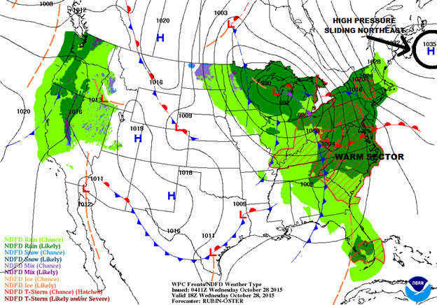
A chance for some stronger storms this aft/eve. High winds will be main threat @WTOP @nbcwashington @WeatherAlertDay pic.twitter.com/ilnepDHPbx
— Lauryn Ricketts (@laurynricketts) October 28, 2015
There is a chance for some flash flooding; however, given the recent dry conditions, the threat looks low. Most of the flooding will take place along the coast and tidal basins along with low-lying and poor-drainage areas. The area will have to keep an eye on some drains that may be clogged with the recent leaf debris as storms and any associated heavy rain develops. After midnight, the cold front will push through to the east, cutting off the rain. Winds will still be on the breezy side for Thursday, and there should be more clouds than sunshine, but temperatures will still be on the mild side, rising into the lower to mid-70s. High pressure builds in on Thursday night, giving way to clearing skies. Look for sunshine on Friday with temperatures around 60s. It will stay around 60 with clouds increasing late in the day on Halloween. Halloween looks fantastic, with evening temperatures in the upper 40s to mid-50s. Sunset on Halloween is just around 6:10 p.m. And don’t forget to set those clocks back before you get your trick-or-treating done! Daylight Saving Time ends on Sunday morning.