
WASHINGTON — We are about to run the gamut of winter weather as we head into the weekend, so be prepared.
A Winter Weather Advisory will be in effect from Warren County, Virginia, to northern Fauquier and Prince William counties, to Prince George’s and Anne Arundel counties in Maryland and points north from midnight until noon Saturday. It will also be in effect for D.C., Prince George’s and Anne Arundel counties until 9 a.m. Saturday. A Winter Storm Watch will be in effect for northern Maryland counties along the Pennsylvania state line, as well as Frederick County, Virginia, and the panhandle of West Virginia, for the same time frame.
Saturday — Weather Alert Morning
The Setup: The high pressure that was over us on Friday moves off the coast Saturday morning. The strong low pressure system scooted out of the Rockies on Friday and headed up to the Great Lakes, bringing a warm front and then a cold front through our area over the weekend. Get ready for some icy conditions Saturday morning, especially for areas north and west of D.C. A winter weather advisory (pink) and a winter storm watch (blue) are in effect through early Saturday morning.
Winter Weather Advisory (purple) & Winter Storm Watch (blue) in effect tonight through Sat AM — glaze of ice poss pic.twitter.com/lBmKRfZ8nE
— Lauryn Ricketts (@laurynricketts) December 16, 2016
Timing and Precipitation Type While snow chances now look slim (warmer air will start working its way in through the atmosphere) it looks like sleet and freezing rain will be the primary precip types from about 2 to 10 a.m. on Saturday. Expect a glaze of ice, especially on untreated surfaces. 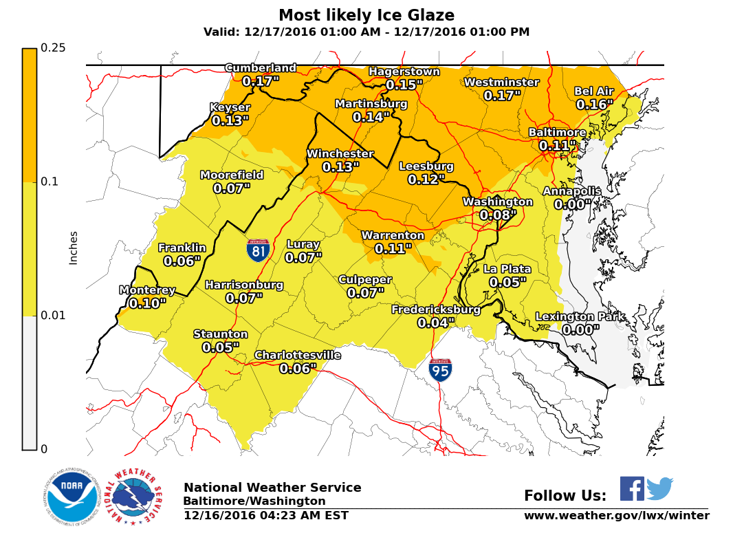
Sunday
Temperatures will approach 60 degrees before noon on Sunday. But a very strong cold front will approach the region, bringing breezy conditions and rain with it early Sunday morning. Expect rain showers to return early Sunday morning and continue through Sunday evening. There could be periods of moderate rain and some downpours as well on Sunday. Temperatures will drop rapidly as the frontal system passes through the region during the afternoon — from the upper 50s before noon to the upper 40s by Sunday afternoon and into the lower 30s by Sunday night. We will have to watch for the potential for some wintry mix/snow to return on Sunday night before all the precipitation is out of here. There could be some slick spots on Monday morning as temperatures will fall into the 20s before daybreak.
Wrapping It Up
Please plan ahead for this roller coaster of weather. Make sure pets are taken care of and put inside; make sure your heat is working and make sure you plan ahead for this big shift in temperatures. We are not expecting a significant winter storm: Precipitation amounts will be small. But the cold air that is here will prove to be very dangerous once the precip begins to fall, and you should think twice before traveling early Saturday morning (again wait until after 10 a.m.). Visit the WTOP weather page for the latest weather updates, and check out the WTOP traffic page for the travel and road conditions.