
Tropical Storm Fernand has slowly gained strength over the Atlantic Ocean and is expected to continue on its path north-northeast for a day or two, the National Hurricane Center said late Sunday.
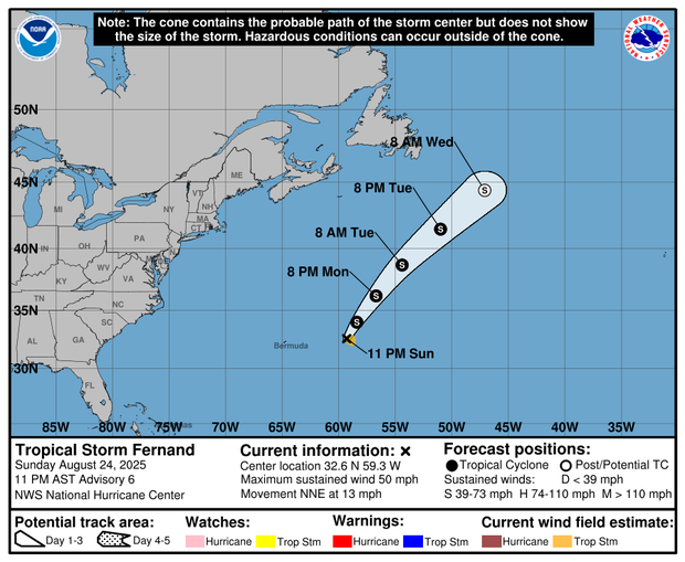
The Miami-based hurricane center’s 11 p.m. ET updates said Fernand was located about 320 miles east of Bermuda with maximum sustained winds of 50 mph. It was moving north-northeast at 13 mph, with tropical-storm-force winds extending outward up to 60 miles from the storm’s center.
Fernand formed southeast of Bermuda on Saturday and it is the sixth named storm of the 2025 Atlantic hurricane season. It comes on the heels of Hurricane Erin, which formed in a similar area on Aug. 15.
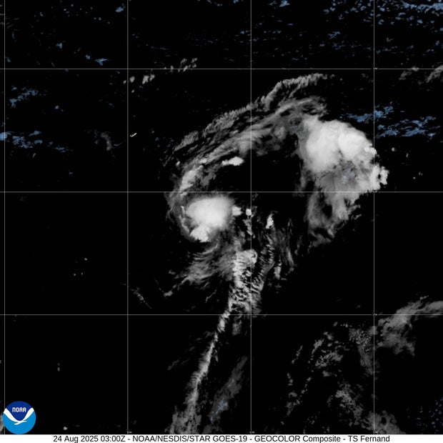
Maps show Tropical Storm Fernand’s forecast path
According to the hurricane center, Fernand was forecast to remain over the open ocean. It was expected to strengthen through Monday before likely beginning to weaken late Monday or on Tuesday, forecasters said.
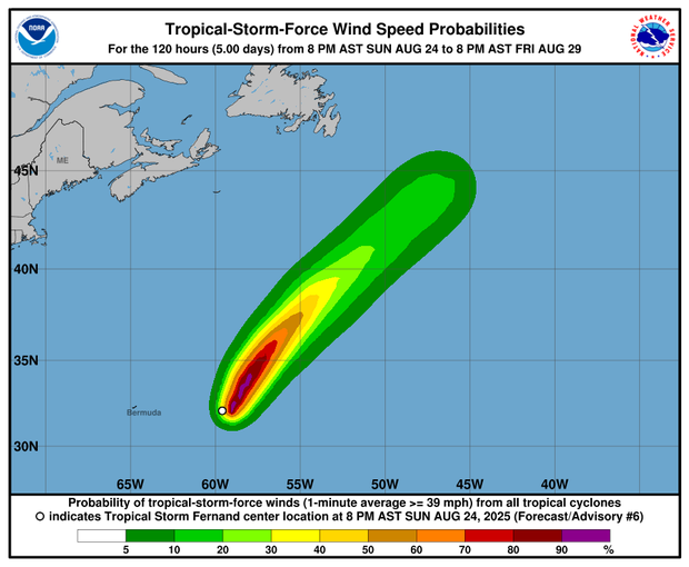
Forecasters predicted it would move north-northeast over the next couple of days.
“On the forecast track, Fernand should move across the open waters of the subtropical central Atlantic well east and northeast of Bermuda,” the NHC said.
2025 Atlantic hurricane season
The National Oceanic and Atmospheric Administration, or NOAA, forecast an above-normal hurricane season this year, predicting there will be between 13 and 18 named storms. Five to nine of those are expected to become hurricanes.
Fernand follows Hurricane Erin, the first storm to become a hurricane this season. Erin didn’t make landfall, but at its peak grew to a ferocious Category 5, and it caused strong winds, dangerous rip currents and flooding along parts of the East Coast.
A tropical storm forms when maximum sustained wind speeds reach at least 39 mph. It becomes a hurricane if winds reach at least 74 mph. Hurricanes are rated on a scale ranging from Category 1 to Category 5, with Categories 3-5 indicating major hurricane strength.