
[connatix_element_embed script_id=d2222dc7ecd04d43a1acb5c31008548b player_id=7bc491b4-922b-4e8d-b1b1-150648e80442 video_id=424472f1-f245-4f86-8d0f-92982b9923c1 align=right]
December is here and it comes with some not-so-merry temperatures as the D.C. region is consumed by below-average cold weather.
With readings hitting the single digits and teens overnight into Tuesday, people across the region received somewhat of a reprieve as the sun’s rays came to stay for the majority of the day.
However, those conditions are only temporary, as Tuesday afternoon is expected to bring with it northwesterly winds hitting between 5 and 15 mph and temperatures reaching into the middle 40s.
Wednesday will bring high temperatures ranging in the low to middle 40s, before Thursday paves the way for “the next weather maker,” according to 7News First Alert Chief Meteorologist Veronica Johnson.
“We’re looking at — 5 a.m., 6 a.m. — some flurries around the area, or rain showers could be even mixing in at times by late morning — 10 to 11 o’clock,” Johnson said. “So, just a little bit of precipitation from this next storm system. What we will have, though, are some wind or gusts during the afternoon could be about 35 to 40 mph.”
Per Johnson, the looming weather system could potentially trigger a wind alert, as gusts could reach 40 mph on Thursday.
If you have any plans to head out to dinner Friday, make sure to bundle up as temperatures are expected to stay in the middle to upper 30s. Those same frosty conditions are set to stick around Saturday before a momentary ease Sunday, with highs in the 50s.
- Listen to WTOP online and on the radio at 103.5 FM or 107.7 FM.
- Current traffic conditions
- Weather forecast
- Closings and Delays
- Sign up for WTOP email alerts
- Get custom alerts with the WTOP app for Apple and Android phones
For people experiencing homelessness in D.C., this kind of weather can be deadly. A hypothermia alert was activated for the city Monday afternoon and is expected to last through Wednesday.
Anthony Newman, deputy administrator for Homeless Services in D.C., said the mission is to help keep people alive.
Speaking at the Emery Shelter in Northeast on Monday night, Newman said you can help the effort by calling when you see someone in need: “We encourage them to call 311, with as much detail about the person as possible, like where you are … the address of the intersection.”
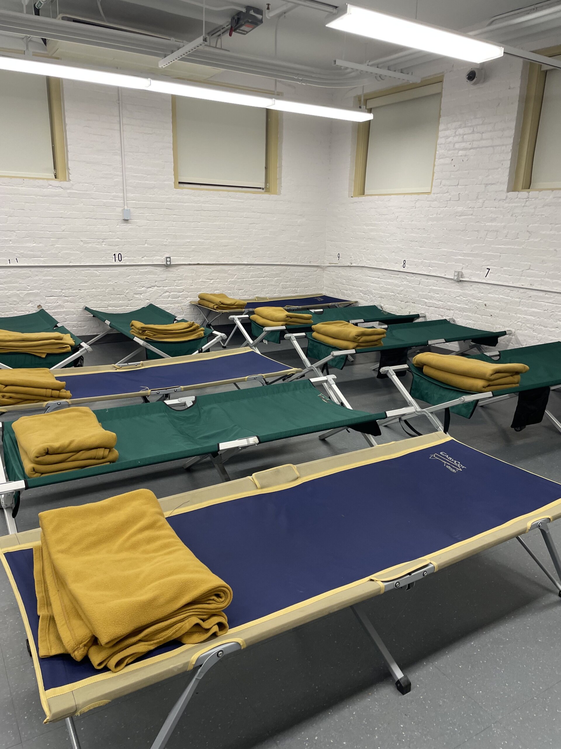
Newman said drivers will be dispatched and offer rides to the Emery Shelter or another one nearby.
“At this particular facility, we can house 60 people,” he said.
Newman added that those who come to shelters can also get a hot meal. The District watches temperatures more closely from November through March, he said, and is committed to ensuring that people experiencing homelessness have access to shelter and transportation.
“It’s to help keep people alive, and that works best when our neighbors help each other out,” he said.
7News First Alert Forecast
TUESDAY: Mostly sunny, breezy and brisk. Highs between 38 and 45.
Winds: Northwest 5-15, gusts 25 mph
TUESDAY NIGHT: Clear and cold. Lows between 16 and 27.
Winds: Northwest 5 mph
WEDNESDAY: Partly sunny. Highs between 40 and 45.
Winds: Southwest 5-15, gusts 25 mph
THURSDAY: Early morning rain/snow showers. Partly sunny, windy. Highs between 43 and 48, wind chills between 35 and 40.
Winds: West 10-20, gusts to 40 mph
FRIDAY: Mostly sunny, breezy. Highs between 35 and 40.
Winds: Northwest 10-20 mph
THIS WEEKEND: Cold, frigid air is expected to ring in the first half of the weekend but, Sunday will usher in slightly warmer temperatures in the high 50s.