
The D.C. area hasn’t experienced much in the way of wintry precipitation this winter, and a mild start to the season has become rather common.
Sunday’s weather system produced a very small snippet of winter weather, with trace amounts of snow falling in Orange County, Virginia. Fredericksburg and Charlottesville also picked up a tenth of an inch of snow/sleet during the storm.
Only trace (enough to see but unmeasurable) amounts have been tallied since Nov. 1 at the official reporting station in D.C., Reagan National Airport. That puts snowfall at 1.7 inches below average so far this season.
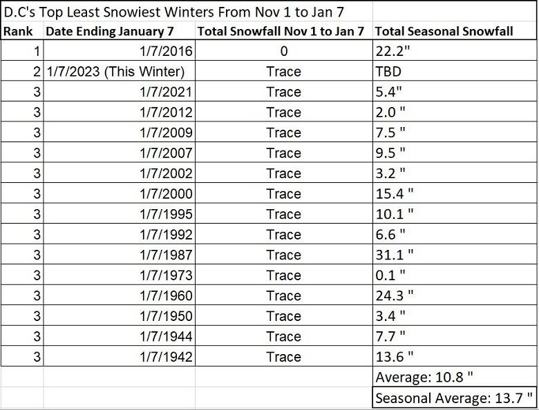
When comparing this winter to previous winters through Jan. 7, the region has been in the same boat 14 other times. During those 14 previous winters with only trace amounts falling through Jan. 7, the average seasonal snowfall was 10.8 inches, below the average seasonal amount of 13.7 inches.
The winter of 1986-87 saw the biggest comeback when 31.1 inches of snow fell after Jan. 7.
Five of the 14 winters listed below were La Nina winters, typically producing less than average snowfall.
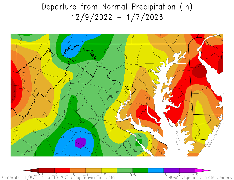
This winter is also driven by La Niña and is likely responsible for the snowfall deficit. Besides a lack of snow, overall precipitation (rain, melted snow and sleet) has been below average for much of the region since the start of the meteorological winter (Dec. 1).
The Atmospheric River of winter storms slamming the West will likely continue unabated through at least the end of the third week in January.
The active Pacific jet stream will keep much of the U.S., including D.C., warmer than average. It will also keep the storm track west of D.C. and snowfall below average inside the nation’s capital.