
It was another sizzling day with heat index values that feel like 107 degrees. As the D.C. area headed home, widely scattered thunderstorms followed right behind. Here’s what you need to know. The heat and humidity led to a somewhat unstable atmosphere that brought a risk of severe weather and heavy rain for parts of the area. Meanwhile, a storm hovering near Braddock Heights is moving east at 15 mph, and could clock wind as high as 60 mph, according to the National Weather Service. The evening remained warm and humid with a small chance of a shower or thunderstorm before midnight in areas west of the D.C. region. In D.C. the Heat Emergency Plan has been activated and residents were encouraged to stay indoors. People in D.C. could also head down to one of the District’s cooling centers. 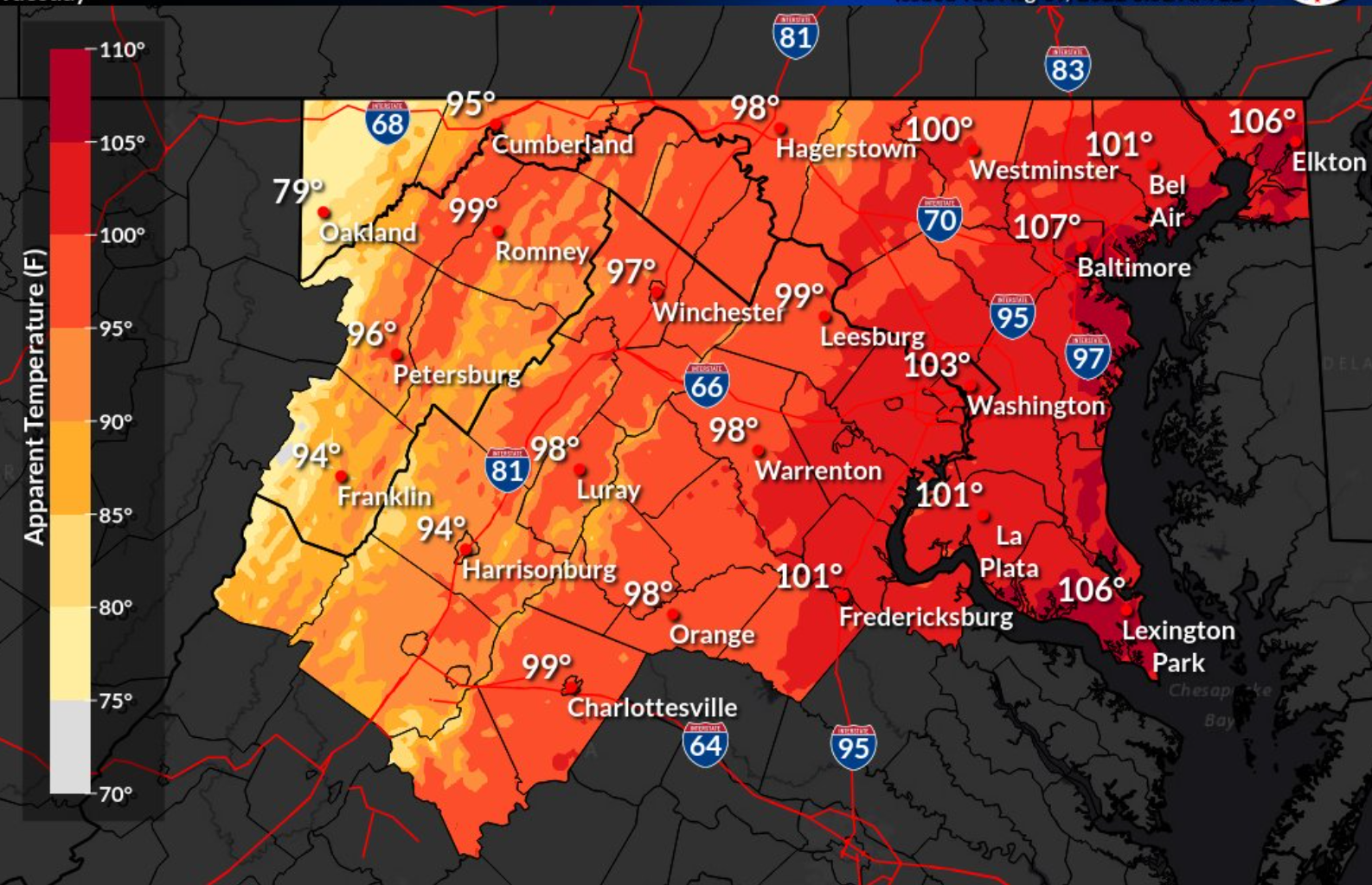
- Listen to WTOP online and on the radio at 103.5 FM or 107.7 FM.
- Current traffic conditions
- Weather forecast
- Sign up for WTOP alerts
Travel
Amtrak says that between 1 p.m. and 7 p.m. trains operating between D.C. and Miami may experience delays because of heat-related speed restrictions.
Flooding issues remain
Between 1 to 4 inches of rain fell in Prince George’s County, Maryland, on Monday, causing flooding on roadways. Flash flooding was reported in the Riverdale area, with rapidly rising water making the roads impassable, Miller said. Two people were stuck in their cars and needed to be recused in the parking lot near the Crestwood Medical Building in Riverdale after flash flooding reached up to 5 inches, WTOP’s Kyle Cooper reported.

To view this content referenced from Instagram, click here.
Why has the D.C. region experienced a recent surge of flooding problems? “Well, you’ve got the combination of impervious surfaces, plus aging infrastructure, along with the occurrence of flash flooding increasing,” said WTOP traffic reporter Dave Dildine, a D.C. area native with over 12 years of road and weather reporting. Storms that release inches of rain in a short period can cause flash flooding issues in any little dip or low spot in area streets. Some fixes are in the works, Dildine said, including cleaning of storm drains prone to flooding and the new D.C. Water tunnel in the Bloomingdale area. However, residents play a role in remaining safe and should pay attention to flash flood warnings. “If you don’t act quickly, and I mean quickly, you’re going to be underwater, and you’re going to be on an inflatable boat being taken away from your car,” Dildine said.
Forecast:
TUESDAY: Hot and humid with a heat index near 100. Strong afternoon storms possible. Highs in the low to mid-90s. WEDNESDAY: Mostly cloudy and cooler with rain and thunder likely. Localized heavy rain possible. Highs in the 80s. THURSDAY: Morning clouds and showers clearing by the afternoon, turning less humid. Highs in the 80s.
Current conditions:
Power outages: