
- Listen to WTOP online and on the radio at 103.5 FM or 107.7 FM.
- Current traffic conditions
- Weather forecast
- Sign up for WTOP alerts
“The heavy rain and gusty winds may blow some petals off the blooms,” Grossman said. “The good news is, the blooms tend to be the strongest while in peak bloom with many petals so hopefully we won’t see much of a change.” Sunday and Monday look chilly, with the potential for rain to kick back up over the weekend, bringing the peak bloom of the area’s cherry blossoms to an end. Storm Team4’s Somara Theodore advises planning your trip for sometime this week. “Your best chance at seeing the cherry blossoms in all their glory will be Friday before that chill sets in,” Theodore said.
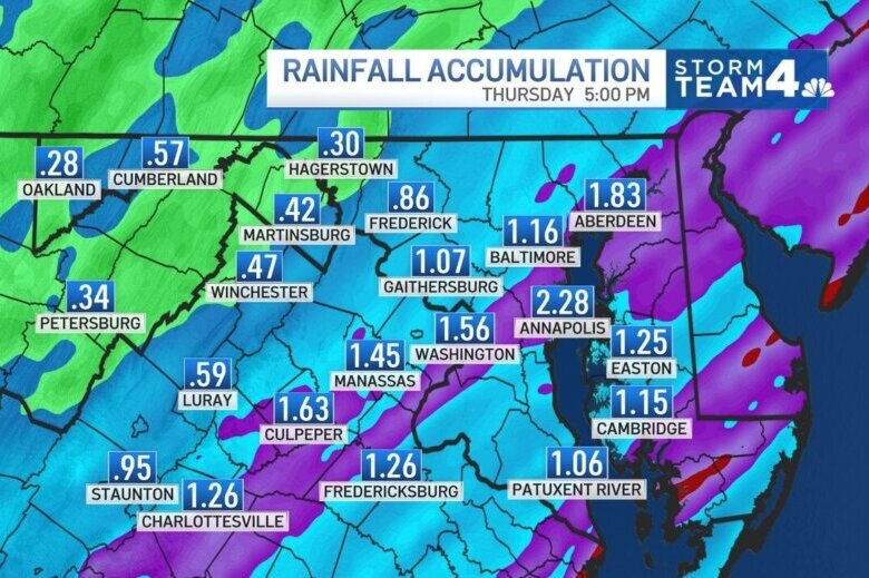
The first drops of rain are expected by noon. Rain will become steady (and briefly heavy) by this evening with 1″ to 2″ possible over the next 36 hours. Friday will likely be the last best-day to see the cherry blossoms before weekend breezes increase. @nbcwashington pic.twitter.com/oevAJrveyc
— Chuck Bell (@ChuckBell4) March 23, 2022
Forecast:
Wednesday night: Rain and a few thunderstorms with lows in the upper 50s. Thursday: Morning thunderstorms and showers will eventually dry with a slight chance for showers and storms in southern Maryland. Highs in the low 70s. Friday: Mostly sunny and gusty with highs in the low 60s. Saturday: Chance for rain showers with highs in the upper 50s. Sunday: Mostly sunny and colder with highs in the low 50s.
Current conditions:
Outages: