
Humidity returned to the D.C. area overnight into Sunday morning, and will continue to rise along with the heat in the coming week. Here’s what you need to know about the coming heat:
- D.C. Mayor Muriel Bowser activated the District’s Heat Emergency Plan for July 12 through July 14.
- Scattered showers and storms, some of which could be severe, are expected through Sunday night.
Temperatures on Sunday topped out around 90 degrees, according to NBC Washington meteorologist Lauryn Ricketts. A chance for scattered thunderstorms remains into the evening, with some potentially carrying heavy rain and strong winds. The National Weather Service said the main threats are damaging winds, torrential downpours, and frequent lightning.
Service Advisory: Trains traveling between Washington (WAS) and Savannah (SAV) may experience delays along the route due to heat-related speed restrictions issued by the host railroad.
— Amtrak Northeast (@AmtrakNECAlerts) July 11, 2021
Conditions prompted Amtrak to issue a service advisory that trains traveling between D.C. (WAS) and Savannah, Georgia (SAV) “may experience delays along the route due to heat-related speed restrictions.” 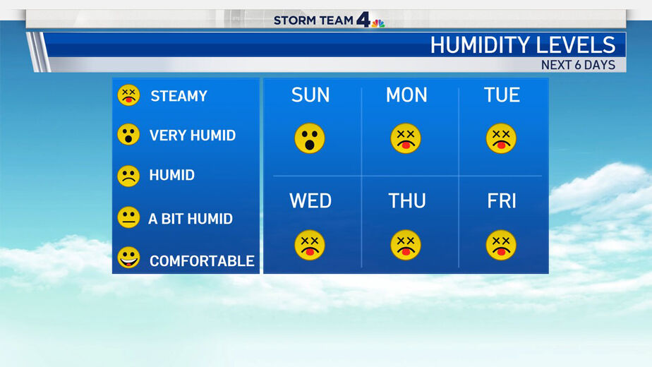
- Listen to WTOP online and on the radio at 103.5 FM or 107.7 FM.
- Current traffic conditions
- Weather forecast
- Closings and Delays
- Sign up for WTOP alerts
Forecast:
- Sunday evening: Mostly cloudy. Warm and humid. A few widely scattered thunderstorms, some locally strong with a chance for heavy downpours. Temperatures falling through the 80s.
- Overnight: A few clouds. Muggy, warm, and uncomfortable. Lows in the low to mid 70s.
- Tuesday: Partly sunny. Hazy, hot, and humid. An isolated afternoon thunderstorm. Highs in the low to mid 90s. Heat Index near 100.
- Wednesday: Mostly cloudy. Hot and humid. Scattered thunderstorms. Highs in the upper 80s to low 90s.